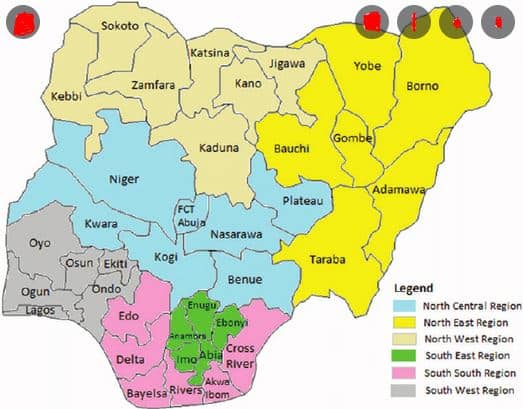
According to the latest release by the office of the Surveyor-General of Nigeria, Borno state is the largest state by land mass and Lagos state is the smallest state by land mass. The details of the states will be explained below and the image released by nigerianstat.gov.ng for the land mass for all the 36 states in Nigeria.
Top 5 Largest States in Nigeria

- Borno State: Lying within latitude 100N and 140N and longitude 11030’E and 14045’E, Borno State which has an area of 72,600sqkm is the largest state in the federation in terms of landmass. The population of the state is estimated to be over 5 million. The state has two major vegetation zones viz; Sahel in the north with severe desert encroachment covering most of the Chad Basin areas and Sudan Savannah in the south which consist of scrubby vegetation with tall tree woodlands. There are three (3) senatorial districts in the state, namely Borno central senatorial district, Borno south senatorial district and Borno north senatorial district.
- Niger State: It is one of the 36 states of Nigeria was created out of the defunct North Western state on 3rd February, 1976. Niger State is one of the largest states in Nigeria covering about 68,900km2 (or about 8.6million hectares) representing about 9.3% of the total land area of the Country. The State Lies On Latitude 80o To 11o:30’ North And Longitude 03o 30’ To 07o 40’ East. The State Is Bordered To The North By Zamfara State, West By Kebbi State, South By Kogi State, South West By Kwara State, North-East By Kaduna State And South East By FCT.
- Taraba State: The state lies roughly between latitude 6030″ and 9036″ north and longitude 90 10″50″ east. It is bounded by Bauchi and Gombe and Adamawa States in the north-east, and by Plateau State in the north-central. The state is further bounded to the north central by both Nasarawa and Benue States, while it shares an international boundary with the Republic of Cameroun to the south and south-east. Taraba State is one of the largest states in Nigeria covering about 56,200sqkm
- Bauchi State: The state was created in 1976 from the North Eastern State of Nigeria. Bauchi State is one of the states in Northern part of Nigeria that spans two distinctive vegetation zones, namely the Sudan savannah and the Sahel Savannah. It has a land mass of 49,119sqkm.
- Yobe State: The state which derived its name from River Yobe, was created as a state on 27th August1991, by the then Federal Military Administration led by retired Army General, Ibrahim Badamasi Babangida. Yobe has a political structure comprising of 17 local government councils and 178 wards. It also has 14 emirate councils. Its capital is Damaturu. The State covers an estimated area of 46,609 square kilometers and shares borders with Borno State to the east, Gombe State to the south, Bauchi State to the west, Jigawa State to the north-west, and has an international border to the north with Niger Republic.
Read: Most peaceful state in Nigeria
Top 3 Smallest States in Nigeria
- Lagos State: Lagos State was created on May 27, 1967 by virtue of States [Creation and Transitional Provisions] Decree No. 14 of 1967 which restructured Nigeria’s Federation into 12 States. The State is located on the South–Western part of Nigeria, on the narrow plain of the Bight of Benin. Lying approximately on longitude 20 42’E and 32 2’E respectively, and between latitude 60 22’N and 60 2’N, The State is bounded in the North and East by Ogun State of Nigeria, in the West by Republic of Benin, and stretches over 180 kilometers along the Guinea Coast of the Bight of Benin on the Atlantic Ocean. Lagos State is the smallest state in Nigeria with a land mass of 3600sqkm.
- Abia State: Abia State also known as God’s own state is one of the five South Eastern Nigerian states with predominantly Igbo people. The state is known for our rich arts and culture, vast human resources, technology, industry and unmatched record for talents in almost areas of life. Lagos State is one of the smallest state in Nigeria with a land mass of 4900sqkm
- Anambra State: The land mass of the state is 4900sqkm